It’s been very busy during September and into October. We’ve had some mixed weather – some glorious Autumn days – some not so! But all volunteers have contributed enormous amount of time to surveys right across the region. With a couple more projects to go next week, we wanted to update all our readers with some initial results.
These are very much preliminary but hopefully give an insight into the varied and interesting sites that local communities have been exploring across the region. We will be processing the data to recognise more of the archaeology present over the coming months.
All the results presented uses greyscale images to ‘map’ buried archaeology.
For resistance surveys this shows areas of high resistance as black – this may relate to buried stonework – such as walls, paths and roads. Areas of low resistance are shown as white – this may indicate cut features filled with wetter soil – such as ditches.
For magnetic surveys areas of positive magnetic response are depicted as black – this may relate to areas of disturbed soils. This may be cause by factors such as burning – so it’s a very good way to spot kilns, hearths and ovens. Cut features, such as pits and ditches which are backfilled with magnetically enhanced soil will also show up as black on the greyscale. Areas of negative magnetic response are shown as white.
As ever, we would like to thank all our volunteers, all landowners for permission to carry out survey and our funders.
Innermessan – where’s the bailey?
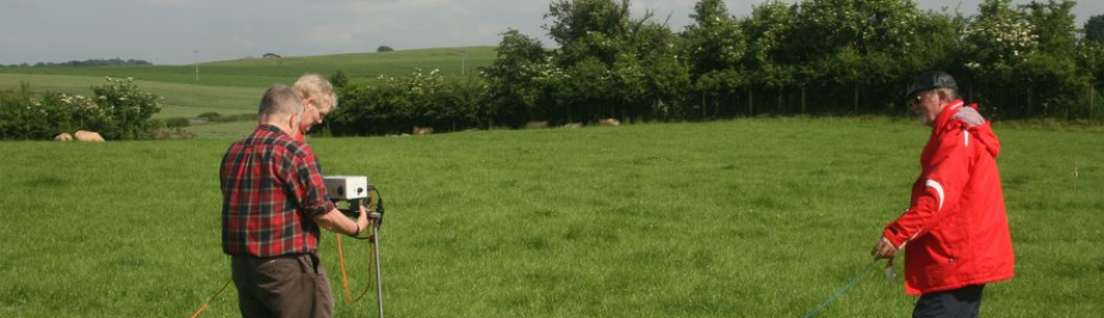
Both magnetic and resistance survey were carried out at Innermessan, to the north of Stranraer by a small team of volunteers between the 11th and 13th September. A flat ‘tongue’ of land around the base of the fine upstanding 12th century motte was targeted – it looked like the most likely area to be the castle bailey.

Innermessan was once a flourishing medieval town – it is depicted as larger than Stranraer on 17th century maps.
Magnetic survey failed to record any distinct features related to the castle’s bailey. However, interestingly a totally unexpected circular feature measuring 8m in diameter was recorded. It appears to be cut by the ditch of the motte – so we can suggest it is an earlier feature. There’s a lot of Iron Age acitvity in the area – particularly on the slopes of Craigcaffie – does this feature date from the same period?
 Resistance survey concentrated on an area to the north. It’s a field which has been suggested as the site of a Roman camp spotted from the air. No sign of the camp is evident, but there’s a number of other intriguing features across the area.
The results are still undergoing processing and interpreting but here’s a sneak preview prepared for the Open Day on Saturday 13th September at Stranraer Library – which provoked some very useful discussion with local residents.

Corehead – searching for the ‘lost’ tower
 A resistance survey was carried out on two sunny days, September 18th and 22nd, at Corehead Farm, near Moffat, with a fabulous view of the Devil’s Beef Tub.
The survey located a number of intriguing anomalies. Some of these relate to features seen on 19th century Ordnance Survey maps, but some are not! The results were presented on the 25th September in Moffat, together with details on the background to the site presented by some of the volunteers.
‘Ye Coreheade’ a towerhouse depicted on a 16th century map, and for which there are numerous literary references, however, doesn’t seem to have been located yet – so the search goes on!

Lochbrow – the hidden history of a prehistoric landscape
A team of dedicated volunteers braved some difficult weather in the third week of September to help carry out survey at Lochbrow, near Johnstonebridge. This flat field has been the subject of investigation by a team from RCAHMS, the Universities of York and Edinburgh since 2010. Working very closely with the Lochbrow Landscape Project Team, volunteers carried out a very detailed resistance survey across this flat field.
What were they looking for? Well, a large number of prehistoric features have been spotted from the air in a number of fields around Lochbrow Farm – including a Neolithic cursus monument (a long processional way), a number of Bronze Age barrows and other intriguing features. Detailed geophysics has significantly added to an understanding of the use of this landscape over several millennia, as we found out at a talk on Wednesday 26th September
The results are still being processed and analysed but early indications were good – a number of pits were showing up in the results! There’s a lot more background on the Lochbrow Landscape Project website.
We also welcomed pupils from both Johnstonebridge Primary School and Dumfries High to the site, and they helped out with survey and seemed to have a good time. See pupils from Dumfries High in action below (courtesy of Ron Addison).
SL274376 from Giles Carey on Vimeo.
Gatehouse-of-Fleet – a cropmark mystery
 On 3rd October, an intrepid team of 12 surveyors joined us to carry out a pilot survey adjacent to Girthon Cemetery, Gatehouse-of-Fleet. This intriguing site was first spotted from the air in 1948. Both quarry pits for the Roman Road running up to a small fort, as well as a number of enclosures, interpreted by some as Early medieval barrows, are evident as cropmarks on aerial photographs.
The aim of the survey was therefore to see if we could record further detail about these cropmarks and spot any details that weren’t evident on the aerial photographs.

Volunteers carried out both magnetic and resistance survey across the site. The results were rapidly downloaded and swift interpretation was carried out in a local hostelry (honestly, no beer was consumed), before being revealed in a talk presented in the evening at Gatehouse community centre, which was attended by many eager to hear the results.

Although further analysis is needed, the Roman road quarry pits are very evident and whilst there are suggestions of barrows, more work is needed to work out exactly what is going on.
You can still get involved
We hope this has wet your appetite for more surveys, although it has been a rapid run through of preliminary results.
The final project surveys are happening next week. You must get in contact ASAP as there are very limited spaces available.
On the 6th and 7th October (this weekend) we will be carrying out resistance survey in front of Threave House, Castle Douglas, between 10am and 4pm. It’s free, so just drop-in and join in!
Between the 11th and 13th October we will be carrying out survey at Kelton Mains, Threave of an intriguing later prehistoric settlement site. There will also be an Open Day on Saturday 13th October, bteween 10am and 4pm at Kelton Mains, Threave, Castle Douglas.

Brilliant work Giles!
Corehead, Moffat. Very fascinating and of huge historical interest too if we can locate the tower. Keep up the good work Giles.