A bit more about Geophysics
Not all archaeology is about excavation.
Geophysics is a way of mapping buried archaeological deposits – be they ditches, pits or building material – without ever breaking the ground surface.
There are two main techniques for geophysical survey:
Resistivity: By passing a small electrical current into the ground, and measuring the amount of resistance that results, it is possible to locate buried remains of archaeological interest.
Resistance is related to the amount of moisture in the soil. Around buried walls, for example, the surrounding soil will often be dryer. The current cannot pass so easily through this dry soil, so stonework can often show up as areas of higher resistance.
This technique is ideal for locating building walls and foundations.
This technique detects extremely small variations in the earth’s magnetic field, caused when the ground has been disturbed by previous activity. Burning, for instance, will often leave a significant magnetic trace.
Magnetometry is excellent for locating ditches, pits, middens, hearths and kilns.
What the surveys will involve:
An ideal survey team consists of 3-5 people.
Firstly, a grid needs to be set up. This grid lets you make sure that you know exactly where you need to take your measurements, and ensures they can be related accurately to what might lie below ground.
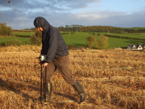
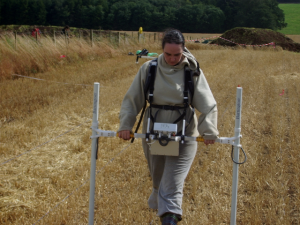
This grid is then walked systematically, taking measurements at regular intervals. In the case of resistivity, metal ‘prongs’ are placed in the ground and a reading is taken. With a magnetometer, you need to walk at a regular pace, taking measurements on a continual basis. The magnetometer reacts to all magnetic responses – so you have to be careful not to wear magnetic metals when undertaking the survey!

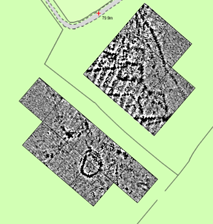
Seeing beneath the ground, and mapping archaeological features: magnetic survey of an Iron Age farmstead
Results from both surveys can be rapidly downloaded onto a laptop computer on site. The great thing about geophysical survey is that, pretty quickly, you can see the results of your labours. These can the be interpreted, to help you understand what might lie below the ground. It can add detail to both known sites, as well as locating previously unknown ones…


Pingback: Birrens:putting a Roman fort in context | Discovering Dumfries and Galloway's Past
Pingback: An exciting Autumn ahead – many opportunities to get involved! | Discovering Dumfries and Galloway's Past
Pingback: A ‘sneak preview’ of the results from Castledykes Park, Dumfries | Discovering Dumfries and Galloway's Past
Pingback: A busy Autumn – some initial results | Discovering Dumfries and Galloway's Past
Pingback: Exploring a later prehistoric landscape on the Threave Estate, Castle Douglas | Discovering Dumfries and Galloway's Past
Pingback: Upcoming event on 21st November: Survey at Langholm Castle | Discovering Dumfries and Galloway's Past
Pingback: Upcoming event on 21st November: Survey at Langholm Castle | Discovering Dumfries and Galloway's Past